
Quick answer
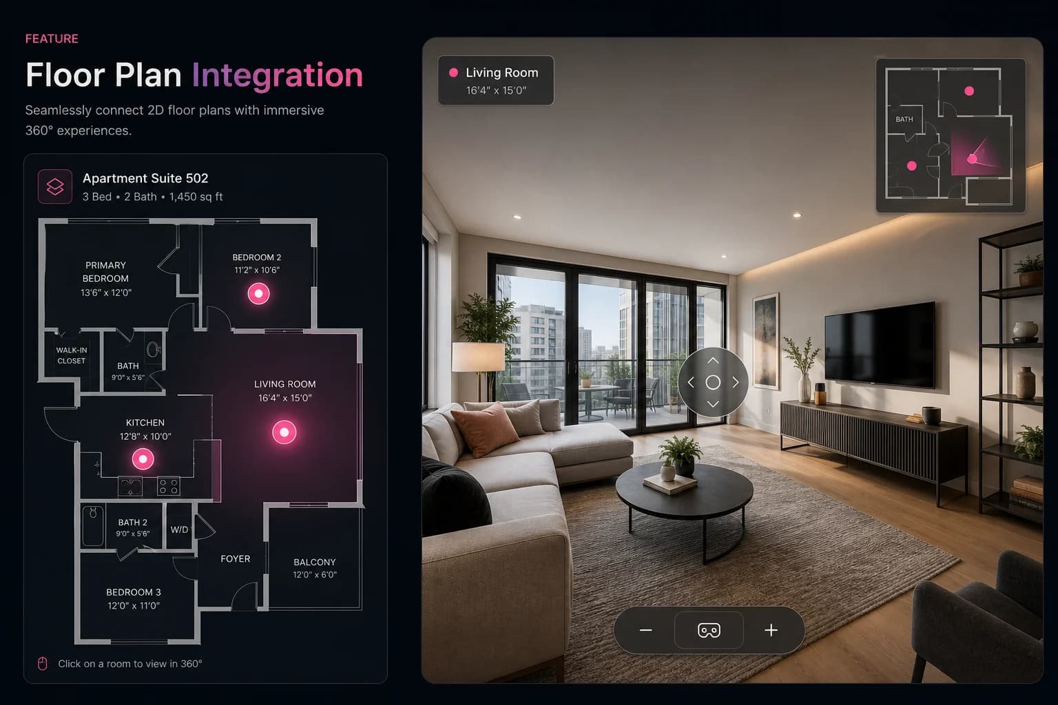
Floor plan integration links uploaded floor plan images to your 360° scenes across multiple levels, giving visitors an interactive minimap to see where they are and jump straight to any room.
Key Takeaways
- Upload image-based floor plans (JPG, PNG, WebP) across multiple floor levels
- Place clickable room markers that jump straight to each 360° scene
- Interactive minimap keeps visitors oriented on desktop and mobile
- Schematic room-connection view (estimated from links, not measured)
- Separate paid service to order professionally drawn plans (20 credits)
Practical benefit
Panoramas show how a room feels, while a floor plan shows how the whole building fits together. Linking the two helps remote buyers and venue visitors orient themselves immediately and jump directly to the rooms they care about.
Main capabilities
Upload your floor plan image, rename levels (such as Ground Floor, First Floor or Site Map), add multiple levels and drop scene markers onto each room. In the public viewer, an interactive minimap highlights the active scene and lets visitors click any marker to move there. You can also generate an estimated schematic room-connection diagram from your hotspot links, or connect interactive floor plans from Planos.
How it works and important distinctions
The interactive floor plan uploader accepts standard image files (not direct PDF uploads). If you do not yet have a drawing, the schematic generator visualises how rooms connect based on hotspots — it is an estimated connection layout, not a measured or dimensionally accurate floor plan. When you need a finished marketing floor plan from your completed tour, you can place a separate paid Floor Plan Order (20 credits) for delivery within 24 hours as downloadable PDF and PNG files.
Availability
The interactive floor plan overlay unlocks on Standard and above. Professional floor plan production orders are a separate paid service charged at 20 credits per order.